The Survey Preparation Menu contains some BETA tools that help the user easily go from an XYZ point cloud to a raster DEM. These tools have been tested in MBES Tools, but not extensively tested in TAT.
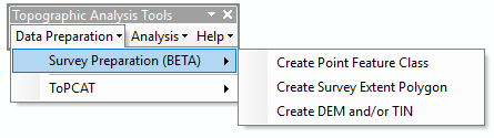
This includes:
- Create Point Feature Class Creates a shapefile from a point cloud file (e.g.
*.pts,*.xyz, etc.) - Create Survey Extent Polygon Creates a bounding polygon around a survey point feature class
- Create DEM and/or TIN Creates a TIN and derives a DEM from that TIN
 Back to TAT Home