The Create TIN and/or DEM tool allows you to derive a TIN and raster DEM in one step.
Create TIN and/or DEM
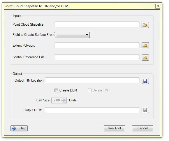
INPUTS:
- Point Cloud Shapefile
- point shapefile containing the original surveyed z values. This file can be created using the Create Point Feature Class tool located under the Data Preparation tab.
- Extent Polygon
- polygon shapefile of the survey extent for the point cloud shapfile. This can be created through in GCD with the Create Survey Extent Polygon Tool.
- Spatial Reference (optional)
- can be in the form of a .prj file or a shapefile that contains a spatial reference.
- Cell Size of DEM (optional)
- The cell size to for the DEM, this option is only activated once the user checks the *Create DEM *option. 2 feet is currently the default
OUTPUTS:
The outputs for the Create TIN and/or DEM tool are:
- TIN(optional)
- TIN created from the original surveyed values contained in the point cloud shapefile. This will not be output if the user selects the *Delete TIN *option
- DEM(optional)
- DEM created from the TIN. This is only created if the user selects the *Create DEM *option.
 Back to TAT Home